Thursday, August 10, 2023

Alzheimer's Century Ride #2 : Whittington Castle

For my second century ride in the challenge I picked a course created by a local cycling club for an Audax event - Audax being the long distance cycling association. The ride to Whittington Castle was described as "not particularly hilly", which sounded great, and I'd already ridden part of the route to Whixall Marina as a warm up at the end of July. The weather looked fairly pleasant with light winds and no rain forecast, so I set off in high spirits following the same start as last week's ride through Winterley and Haslington, before turning off to Weston. It has a couple of inclines to get the heart going, but nothing too strenuous, and from Weston I headed to Wybunbury, where rather than turning right to go through the pretty village as I usually do I turned left to cross the A51 and head to Audlem. The road was winding and slightly undulating, taking me past lots of fields full of tall maize, before a climb into Hankelow had me puffing into Audlem.

Audlem has a pretty centre, and turning right onto the A525 I crossed the Shropshire Union canal and descended out of town, a short climb then taking me to turn right onto Coole Lane. I turned left shortly, following the Cheshire Cycleway, along a nice lane passing some farm buildings, with a couple of dips for fun. At the end I turned left and crossed the A525 onto another narrow quiet lane, albeit with a bumpy, potholed stretch to start with. 

Turning right, and then left, I noticed a rather cute windmill on a house fence, of a black cat riding a bike. As I was taking a photo of it, two cyclists went by in the direction I was heading, one male and one female. Starting off again, I hadn't gone far when I paused to allow a tractor and following car with trailer to come past, the lane was fairy narrow at this point and it would have been a tight squeeze for us both to be on the same part of the road. A little further on I passed the two cyclists - the gent was having a wee against a gate, and as it would have been rude to acknowledge this I didn't say Hi again. The road seemed to go on forever, through verdant farmland, until I eventually came to Ightfield, and from there briefly joined the main road before turning off to Ightfield Heath. The glorious countryside continued, and I felt that I could have been looking at a pre WWII countryside scene, half expecting to see old style tractors and people helping with the harvest. 

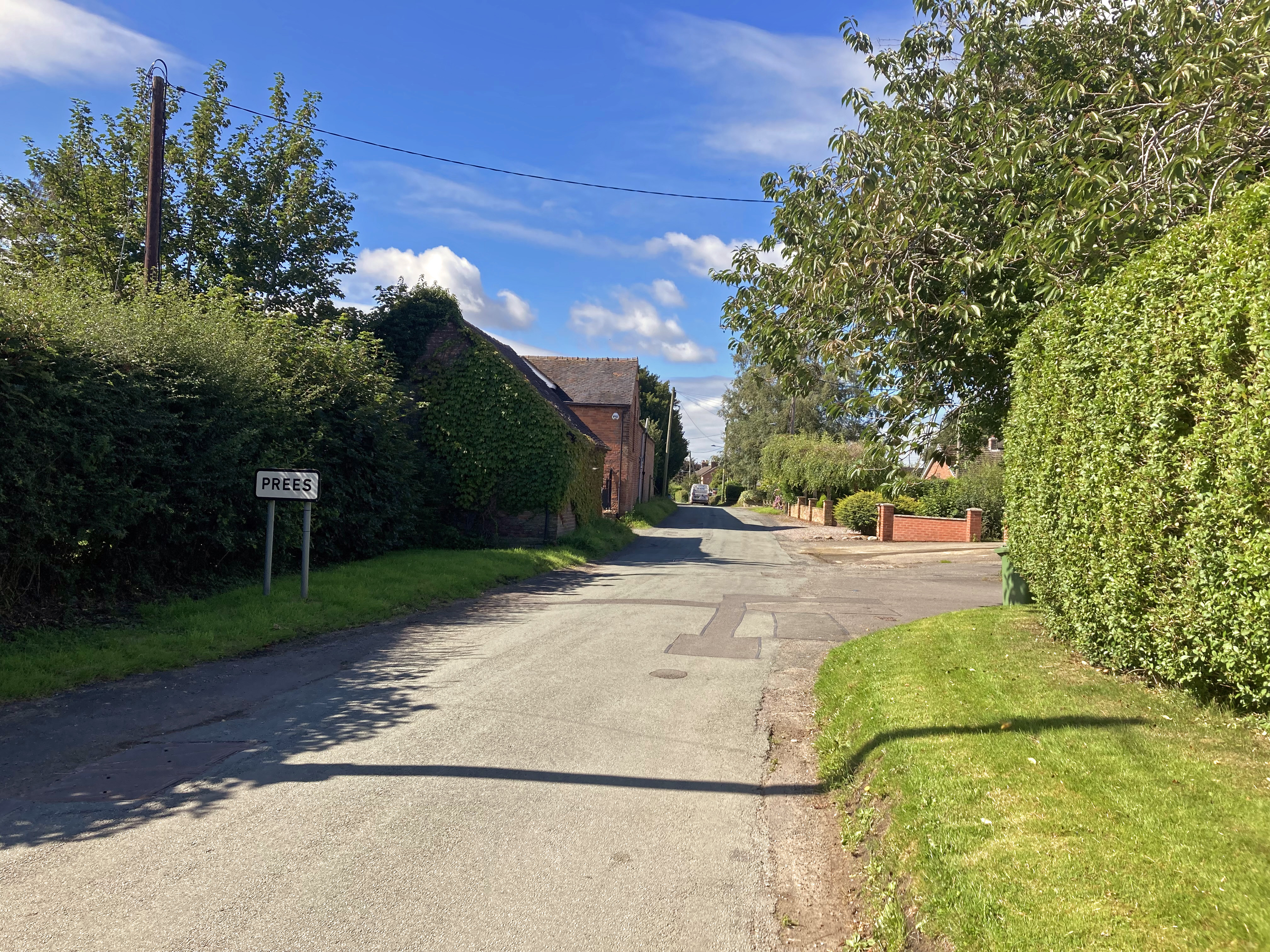
Eventually I came to the busy A41, and carefully crossed over to enter Prees. I headed past the houses and came to a junction at the pretty church of St Chad, where I turned right to descend under the A49 and cross Whitchurch Road to leave the village, After a mile I came to Prees railway station, where I had to stop due to the level crossing barriers being down, red lights flashing. After what seemed like an eternity (I swear it was at least five minutes!) a four car unit sped past heading for Shrewsbury, the barriers lifted and I continued on my way. A left at the next junction, then a right into Post Office Lane took me to Whixall. Shortly after I passed an old man on a small wheeled bike at a junction, consulting a map, and in a short while the first pit stop of the day appeared - Whixall Marina Cafe. 

I stopped off for a coffee and a flapjack here before resuming my journey, turning right at the next junction in Northwood to graze the Welsh - English border. On my previous visit to Whixall Marina I had turned off here into Wales, but today I went straight on, remaining in England for the time on new roads. In a short while, I turned left following the blue cycle signs for Oswestry (17 miles) and Ellesmere (6). The road turned into a very leafy lane, with tall hedgerows and trees either side, where I again stopped to give way to an oncoming vehicle. 

At the hamlet of Lyneal, my route took me right and then left into another long, leafy lane, rather aptly called The Avenue, which took me to Colemere, where I came across the old man with the small wheeled bike again. At Colemere there is a mere (Cole Mere not surprisingly) and I also noticed some vines growing in a field, something you'd expect to see in France, not in north west England! Apparently you can get Colemere wines, red, white, rose and sparkling versions all available, as well as vineyard tours (www.colemere.co.uk). Further along the road I came across a warning of Heavy Plant Crossing, and rode past a huge sand quarry on my right, with what looked like a processing plant on my left. Hands down the ugliest part of my ride so far, and a stark contrast to the gorgeous countryside that I'd ridden through all day. At the junction with the main road, I crossed over and cycled past White Mere (base for Shropshire Sailing Club) and on to Lee, where I turned right at a junction (with a rather large articulated lorry reversing towards me on my left) and then left towards Tetchill, where I finally came to a road that was capable of two vehicles side by side (not that I had been missing one at all!). The road continued through Tetchill and on to Hordley, all the while the hedgerows were quite tall which prevented me seeing much of the countryside, although I was getting the occasional glimpses of the Welsh hills brooding in the distance. Soon though, having passed Rednal, I noticed a canal to my left - the Montgomery Canal - and the road followed this dead straight to Queen's Head, where indeed there was a pub called The Queen's Head. I turned right here, and right again to head towards Whittington and lunch. Along the way, I felt the call of nature, and found a fairly secluded spot for a wee, at which point I heard a bird going eee-tut-tut-tut over and over, presumably telling me off for peeing in public.

In Whittington the twin towers of Whittington Castle came into sight, and I dismounted to walk over the bridge into the castle itself. It is the UK's only community owned castle, although there isn't a great deal left of it to be perfectly honest. I decided on Jumbo Fish Finger sandwich, with chips (not salad), and when it came I suspected that it may not have been the wisest of choices. It was huge, but fabulously tasty, but I did wonder how I'd feel back on the road again. Forty-five minutes later I found out, and it wasn't brilliant. I felt stuffed, and struggled with turning the pedals after my stop. Having left Whittington, I turned right down another undulating quiet lane, at one point seeing a dog apparently on its own and wondering if it was friendly, before relievedly seeing it's owner who called it to heel. At the end of this lane I turned right into St Martin's Road, crossing the Shropshire Union Canal Llangollen Branch and coming into St Martin's itself, where I passed a huge Nisa Extra called Stan's Superstore! After St Martin's I rode through Street Dinas and Sodylt Bank before crossing into Wales unheralded at Shellbrook Bridge. No sooner was I in Wales than I hit some roadworks at the bottom of a hill, and of course was stopped by the red light! Setting off again, I struggled uphill and passed Knolton Farmhouse Cheese, looking more like a large factory than a farmhouse, which intriguingly advertised a cheese machine. In a short while I turned left on the A528 to Overton, where I crossed over and through to pick up the Bangor Road. 

I passed Bangor-On-Dee racecourse and rode alongside the River Dee for a short while, although it was mainly hidden by hedges, before entering Bangor-On-Dee (or Bangor-Is-Y-Coed). After riding underneath the A525 main road I came across St Dunawd's Church with its associated cemetery, looking very stately in the cloudy weather. I'd been to Bangor twice before, and had seen the church, but not from this viewpoint, so stopped for a photo. From this point I knew there was some serious climbing up to Malpas - I'd ridden from Malpas to Bangor before and seemed to remember a long steep downhill, so was looking ahead with some trepidation. Setting off again, the road climbed for a mile and hit a maximum of 9% before a mile of downhill gave some respite. I road through the pretty village of Worthenbury, with a pretty church, after which the road started climbing again, and continued climbing for five miles to Malpas. 

Just before Threapwood a road signed announced I was arriving in England, and I stopped for a photo. Although the road was continually climbing, it wasn't as bad as I had feared, and I was able to keep a good momentum up. The last little bit into Malpas reared up, and I entered the town and turned left at the next junction for a little more climbing out of town, which shortly became a nice little descent into a tight left hand bend before continuing downhill to Tilston, where I turned right towards Carden Park. At the park, I cycled past the golf course, where retired men and women were enjoying their games, and crossed the A534 at Crutton towards Chowley. Crossing the A41 onto Rocky Lane, I headed towards Tattenhall where a right and then left brought me to roads from last week's ride, only in the opposite direction. I recognised the building site that I had passed last week, thinking how strange it was to be seeing things from the other way. In a short while I turned right and came to Manor Farm, and Old Ma's Coffee Shop. I stopped, but only to text an ETA home, as I didn't want to be home too late and it was looking like a 5:15 return without a stop. Setting off again, I headed straight on at the next crossroads and rode past a busy Ice Cream Farm before reaching Tattenhall Lane, where I rejoined last week's route (in the right direction this time). At Beeston Castle I left last week's route, and followed the road through to Bunbury, passing St Boniface's Church and crossing the Shropshire Union Canal at the Staircase Locks. Reaching the main road at Alpraham, the traffic seemed backed up by traffic lights heading towards Calveley, but I nipped into a gap and got through fairly quickly. Turning left shortly after, I hooked up with last week's route again on Long Lane, and followed this to Wettenhall, Cholmondeston and Church Minshull to negotiate the stiff climb out of the village, which I managed reasonably comfortably. At Minshull United Reformed Church, where a Yorkshire flag was flying, presumably in recognition of the recent Yorkshire Day, I turned left for Minshull Vernon and then left again for the A530 towards Middlewich. More roadworks stopped me on the climb of the railway bridge, but after negotiating these it wasn't long before I turned off on Chapel Lane to take the last little undulations down Forge Mill Lane, then left into Warmingham, right into Crabmill Lane and left into Hall Lane to reach the final drag up and over the canal bridge. Under the railway bridge and right into Elton Road, and uphill (slightly, but it's a bugger at the end of a long ride) back to the house. 

It had been a hard, but very enjoyable ride, through some lovely traffic free lanes, although the last hour or so found me not looking at the scenery so much due to being somewhat knackered! I'd only done two stops again, although in contrast to last week, where I had a long drag in the middle section of the ride, this time I did the last fifty miles without a break. Maybe for the next ride I'll look to get a third stop in, and will almost certainly NOT have a huge lunch at the midpoint. 


Friday, August 4, 2023

Alzheimer's Century Ride #1 : Tour de Cheshire

For my first 100 mile ride in the challenge I used a route that I'd planned a out a while ago when I was thinking of doing a century ride. I hadn't studied it too closely for this ride, as I didn't want to worry too much about what was coming up many miles ahead! After a decent breakfast I set off, pausing for the obligatory photo, and rode out of Sandbach for Alsager just after half past eight. The weather was fine, with a little wind (due to pick up around lunchtime) and only a short spell of rain forecast (again, around lunchtime), so I stuffed a rain jacket in my middle top in readiness for it. Food-wise I carried three energy bars and four gels, along with two 750ml water bottles.

On the climb up to Alsager I kept reminding myself that it was a marathon, not a sprint, and took it fairly steadily, not wanting to use all my energy in the first half of the ride. Despite feeling a little tired when I woke up, the ride itself felt fine and it was good to be riding through leafy lanes, Coming into Alsager I was passed by a female cyclist wearing a GB Age Group tri suit. A little further on she was stopped at some road works and we had a little chat before setting off again. She disappeared fairly quickly, and I found myself having to ease off a bit, having caught the "got to keep up with the cyclist that just passed me" bug! I was expecting to head through Alsager and turn left onto the A50 for Holmes Chapel and Knutsford, but was surprised when the route turned left in the centre of town, eventually bringing me out at the familiar Borrow Pit Meadows, and from here through Hassall Green on familiar roads to Smallwood. After Smallwood my route took me to Congleton and down a nice 10% drop, from which of course there was a similar short uphill to Somerford Booths! A left turn at the top took me past the World Famous (at least here in Cheshire) Clonter Opera, then to Lower Withington and past Jodrell Bank. The radio telescopes were sadly not upright, which would have made for a decent picture, but flat. At the roundabout at Chelford I passed the Village Hall, which I'd visited a few times in my time-trialling days, and went under the railway line to Gatley Green, along Welsh Row to face the start of the biggest climb of the day - up Artists Lane to The Wizard, nearly two miles at an average of 3.4%. I toiled my way up, and at the top headed over the road to the first pit stop of the day - The Wizard Tearoom.


Here I had a capuccino and a sumptuous raspberry and oat rye muffin, still warm! I checked my bike as it had developed an annoying rattle after Chelford and found my rear mudguard had come loose at the seat stay bridge. I quickly fixed this and prepared to set off at eleven o'clock. I overheard the staff at the cafe saying that it was raining, bang on time, although my forecast only had rain from twelve. Fortunately it didn't come to much, and I set off down the hill into Alderley Edge. I hadn't been down this road for a long while, as there were too many potholes, but to my surprise I found the road a lot better, and dropped into Alderley much happier than previously. At the bottom of the hill I crossed over into Chorley Hall Lane, where there used to be a football pitch on which I once scored a goal for Barclays Radbroke Hall Sunday team. From there I headed to Lindow End, past Wilmslow Golf Course and on to Ollerton, where I joined the Knutsford Road. I had ridden along this road many times in my time trialling days, and indeed my only 100 mile TT would have used this road. I headed through Knutsford with grey ominous clouds overhead, and took the route through Tatton Park, where I saw a group of male deer lying under a tree. At this point the rain was starting to fall and I took the opportunity to stop, have an energy bar and put my rain jacket on. 


The rain became persistent, but not that heavy, and I left the park and headed to Rostherne, on new roads for me. Although wet it was quite a pretty route with some lovely buildings and lots of greenery. At Rostherene I turned left towards Bucklow Hill, which I had been a little concerned with as it used to be a very busy junction before the M6/M56 link road was built. Now though, the traffic lights have gone (save for a set of pedestrian crossing lights) and I sailed through towards High Legh easily. Eventually I came to the busy A50, and headed into High Legh, turning left at the garden centre. I crossed over the M6, where a group of people were standing on the bridge with cameras in hand, for what I do not know! A little while later I stopped to take my rain jacket off, as the rain had now stopped and there were signs of it clearing. Continuing on, I passed signs for Arley Hall and Great Budworth Alpaca Walking. This was another nice, green section of the route, and at one point a dragonfly flew out ahead of me. Entering Great Budworth the road was atrocious, with so many pot holes, but the village itself is pretty, with a nice church.


Leaving Great Budworth downhill, I crossed the main road to go uphill towards Comberbach, where I turned left towards Marbury. Here there were signs saying the road was closed, which caused a bit of concern. I pressed on though, as often there is a way through for cyclists. I passed Anderton Boat Lift and Marbury Country Park, and eventually came to the road works on Soot Hill which confirmed the road was closed, "except for cycles" - result! I turned left at Winnington Swing Bridge into Northwich, and then right on Winnington Avenue, past what used to be a large ICI works, towards Weaverham. The wind had picked up by now, and had become a head wind, and it started to get hard. Through Weaverham and past Acton Bridge, the road became rolling and rough, which didn't help with the strong head wind, and going uphill through Kingsley was a real struggle. Eventually I came to a crossroads, and headed straight over to continue climbing for a short while before dropping down to Hatchmere, where I turned right on the forest road through what looked to be a very busy Delamere Forest. The forest road (actually Ashton Road) is a nice switchback through the forest, and momentum gained downhill helps with the next uphill section. Ashton Road became Delamere Road, and at the end of this I turned left towards Ashton Hayes where I turned into Duck Road, onto Kelsall Road and onto the busy Kelsall Bypass for a short while, finally turning left into Kelsall itself. This was another grind, and I'd expected to be turning right for Weetwood Brewery, however my route took me onwards and upwards(!) to eventually turn right to where I knew the old Kelsall Cycles was. After a bit more climbing / struggling, I cycled past Willington and enjoyed a good downhill blast to the A51 at Clotton. Here, I crossed the busy road into the aptly named Corkscrew Lane which twisted and turned towards Huxley. At Huxley, I knew where I was and, more importantly, where the next pit stop was going to be! I started thinking about what I was going to order, settling on a nice teacake with jam and a coffee. At the end of Huxley Lane I turned left into Red Lane, and more short, steep climbs to hurt my legs. Finally, I turned right into Newton Lane and after a short while the welcoming sight of Manor Farm and Old Ma's Coffee Shop brought a welcome and much needed rest to proceedings.


Here, I found an amendment to the rule about knowing when the cafe closes - know when the kitchen of the cafe closes! It closed at Old Ma's at 2pm, so at 2:26 my hopes of a teacake went up in smoke. I settled on a piece of chocolate cake instead - not the same. I stretched my legs as I ate and drank, thinking that the next, and final, part of the route would be with a wind mostly favourable. Setting off again just before 3pm, I had a short stretch into the wind before turning back on myself for home. Riding through Tattenhall, I had a good idea where the route would take me now as I'd been that way before, and it wasn't long before I was turning left into Bird's Lane heading towards Beeston. Every slight incline now was beginning to feel like Alpe D'Huez, although I was still going well on level ground. Soon, Beeston Castle came into view ahead of me, which meant more climbing. That was tempered though by what I thought would be a reasonable ride home after I'd passed the castle. 


No such luck though! A little while later, my computer told me to take a left, then another left, and I knew what was coming up! Passing underneath Beeston Castle, I turned off on the descent of Bates Mill Lane towards the Shropshire Union Canal. It was good to get a rest from pedalling as I flew downhill, but I knew that an equal uphill awaited after the canal, followed by a long drag into Tarporley. 


I stopped to take a picture at the picturesque canal bridge, then pushed on to attack the uphill. Strangely, I found this to be not as bad as expected, and after joining the main road and turning for Tarporley, the drag up didn't seem as hard as anticipated either. I went through Tarporley and took Eaton Road for Eaton (no surprise there!) where I turned into Edgewell Lane and onto an old familiar road for me, and I found I was still keeping up a good pace. Eventually I turned left into Alpraham Green and at the end turned left into Long Lane. This brought me out at Wettenhall, where I turned right for Cholmondeston, and here I turned left for Church Minshull. I knew the climb out of Church Minshull would be a killer, so took it easy for a while to try to save energy. At Church Minshull I was stopped at the bridge before the climb by traffic coming through (and ignoring the Give Way to Traffic Leaving The Village notice, or following the It's OK To Ignore Signs If You Are Following Another Car rule), so had to set off from standing start. It's a slog on a rough section of verge at times, so I had to weave a little, but I kept going and made it over the climb and the subsequent nasty little stinger of the canal bridge, and then followed the road round to the traffic lights at Minshulls Garden Centre. Here I turned left, then right to avoid the closure of Flowers Lane, feeling not too bad as I rode along. In Leighton I turned left, crossing the railway bridge (sting in the legs), and following the road past the White Lion at Coppenhall Moss (what wouldn't I give for a beer now!). I'd switched from map view to time / distance on my computer by now, and watched as the three figures clocked up on the display - 100 miles! A short while later I turned right into Hall Lane for the final leg home, took the last stinger of the canal bridge climb in my stride, went under the railway and turned into Elton Road - home, slightly under eight hours since I'd set off! 


It had been a good day out, although I was bloody knackered at the end. I was pleased with the final time, given I'd not done a hundred mile ride in thirty years, and am looking forward to the next one with a little less trepidation now.

Tuesday, July 25, 2023

How to ride 100 miles (1) : Don't

The last time I rode 100 miles it was non-stop, a time trial, and I completed it in 5 hours 1 minute. I was miffed, as I wanted to do it in "evens", a time trialling term for 20mph average, so to miss out by one minute was incredibly frustrating. It was the only 100 mile time trial I did. I was around thirty then, today I'm ecstatic if I average 16mph, and usually do less. Still, it's more about the enjoyment and surroundings now (and the cake) rather than the speed. I've been hankering at doing a century ride for a while, and now with the Alzheimer's Society 100 mile in August challenge I've the perfect excuse. So, how do you ride 100 miles? 

1 : Don't. I have a course planned that will split the distance down into a series of manageable chunks, so the idea is to ride for a while, stop for refreshments, get back on and do some more, stop for more refreshments, and so on until reaching the century. My typical ride is around two hours / thirty miles, so I'm looking at three chunks of around thirty miles, each of which will be a less daunting ride than a straight one hundred.

2 : Cafes. Refreshment stops are to be an experience, not a necessity. Why drink a takeaway coffee and snack standing up at a Nisa Local / Tesco Express / Garage when you could be sitting on a comfy chair with a cup of decent coffee and a sizeable slab of cake? Much more relaxing and revitalising, and if the weather is inclement much more cosy. The only down side is you could be tempted to stay too long, with the risk of seizing up and facing a struggle to get going again. So, plan your route to include a good cafe at the end of each split. And remember to check opening times of your intended cafe - there is a cracking looking cafe in Devon that I planned to stop at on my Devon Coast to Coast ride only to find that a) it didn't open on Monday (when I was going South) and b) it closed a quarter of an hour before I arrived on the Tuesday (going North). 


3 : Progress goes up, not down. Tick off the miles as they go past, rather than looking at how far there is left to ride. It's better to celebrate completing twenty miles than think that you've still got eighty miles to go. 

4 : Be a mobile cafe. Carry extra food in your pockets, and drink lots of fluid. I'll probably take two or three Eat Natural bars of different flavours and textures, a couple of Trek White Choc and raspberry protein bars (other brands of bars are available of course!), a couple of energy gels and take two large water bottles on the bike, which I'll refill with water at the cafe and pop a hydration tablet in. These will supplement the cafe stops and will ensure you don't run out of energy miles from the next cafe stop. Not too many though, it'll be a struggle to fit into your pockets and unwanted weight.

5 : Don't look at the road. Enjoy the surrounding scenery and countryside, take it all in. Don't slump and stare straight ahead at the road - it'll make the ride seem longer and more of a struggle. Obviously keep an eye on where you're riding though - you don't want to end up in the ditch or in a huge pothole! 


6 : JFDI!

So that's the theory - next step is to put it into practice with my first ride on my take on the Alzheimer's Society 100 miles in August challenge.